The latest current satellite shows that it's rain cloud convection was sheared off across Central Luzon, Southern Luzon, Western Visayas particularly the Northern part of the region while it is still embedded along the active ITCZ.
Friday, June 25, 2010
Based on the latest satellite, a new convective clouds over Southwest part of Guam has been showing increasing vorticity. Few of the numerical weather guidance models show possible formation of Tropical Cyclone within the next 2-3 days.If the said convective clouds will gain more strength this would be the next Tropical Cyclone in the Western Pacific and in the country. This will be closely monitored for further development.A new southwest wind flow spotted as it approaches Western parts of the country after bringing heavy rainfalls in Singapore.The Inter-Tropical Convergence Zone remains dominant for several weeks in Southern part of the country but the NOAA rainfall concentrated this ITCZ over Luzon. This means that ITCZ will slowly moving north.
As of now, no potential disturbance spotted but ITCZ remains active. Due to more unfavorable condition and environment, no Tropical Cyclone Formation is possible within the next 2-3 days.
Based on the latest satellite, no active disturbance spotted but ITCZ remains dominant over the Pacific region.
SYPNOSIS:
Southern Luzon, Visayas and MIndanao will experienced thunderstorm and scattered rainshowers due to ITCZ. Other parts of the country can experienced fair sky but with have scattered rainshowers.
Tuesday, June 15, 2010
Based on the latest satellite possible formation of thunderstorms and amount of rainfall now heading towards Eastern Mindanao and Palau while the second one was spotted over the Micronesia region.
SYPNOSIS:
1. Ridge of High Pressure Area extending across Luzon and Visayas. 2.Inter-Tropical Convergence Zone affecting Southern Visayas and Mindanao.
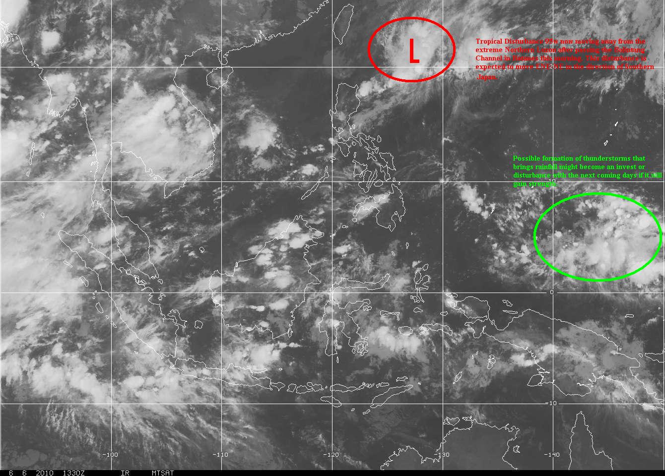
T2K Tropical Cyclone Watch [As of 12:00 PM June 07, 2010]: Weak LPA (95W/1011 MB) moving away from Extreme Northern Luzon or near 20.2N 123.5E. About 160 km ESE of Basco, Batanes...moving NE @ 19 kph towards Ryukyus. Will enhance the SW Windflow across Western Luzon incl. Metro Manila.
T2K Tropical Cyclone Watch [As of 6:00 PM June 05, 2010]: Developing LPA (95W/1010 MB) approaching Ilocos Provinces or near 17.7N 118.6E. About 190 km West of Vigan City...moving ENE @ 24 kph towards Ilocos Provs. Will enhance the SW Windflow across Western & Northern Luzon this weekend.